Snow for Many, Cold for All
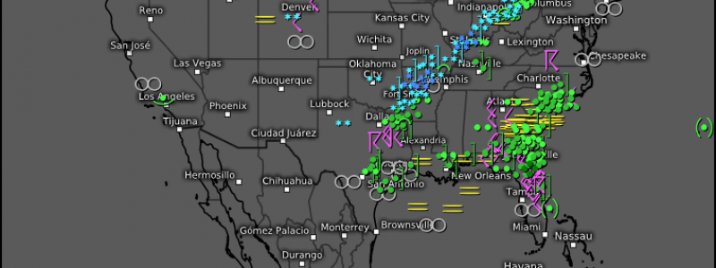
Looking at the current temperatures this afternoon, it’s hard to imagine that the same areas that are currently in the 50s, 60s, and 70s are also under winter storm warnings or winter weather advisories.
But, it’s true. Snow is on the way (or already occurring, depending on where you are) as Arctic air filtering into the north-central US sends temps crashing down and rain changes over to snow.
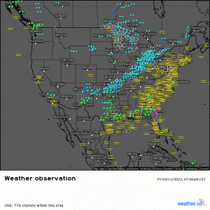
Using current observations, we see that line of snow moving inexorably east.
Below that, in the warm sector, showers and thunderstorms are ongoing. These could become severe this evening as the cold front arrives from the west. Damaging winds are the main threat, but a few tornadoes can’t be ruled out. This threat will persist – from the Gulf Coast to the Carolinas – into the overnight hours. Be sure to have ways to receive warnings, including one that will wake you if need be.
But, back to the snow.
As mentioned, temps will fall hard over the next few hours. Places like Tennessee, Alabama, and Mississippi, which are in the 60s and 70s this afternoon, will be near/below freezing by midnight.
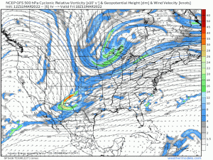
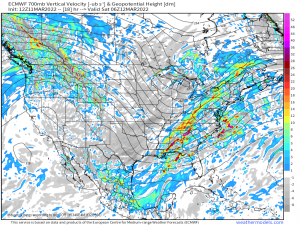
The two disturbances approaching from the west meet, phase, and deepen over the southeast. Essentially, the system will undergo frontogenesis. This deepening will allow for strong upward motion as the cold air rushes toward the moisture.
This could result in convectively enhanced snowfall. Think thunderstorms – but with snow instead of rain. Very heavy snowfall rates are likely with this scenario . There is even the possibility of thundersnow.
Those under this band, if it sets up, will see enhanced snowfall totals, possibly a few inches over what is forecast. A possible position for this band is over the Plateau region of Tennessee and into eastern Kentucky. Most current guidance points toward a maximum in this general area. Of course, the atmosphere does what it wants regardless of what the models say, so that can change and is only a forecast based on my analysis.
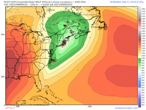
Early Saturday, this system will begin to transfer energy from an inland low to an offshore low. Unfortunately for snow lovers along the i-95 corridor, it won’t quite be far enough offshore for an all-snow event.
Rain to mix to snow will occur along the coast with snow inland. As this will be a quick-mover and won’t linger to continually dump heavy snow inland, the biggest totals will once again be found in the elevations where upslope flow assists in enhancing snowfall. Totals along the coast are expected to be light and likely mixed with some slush.
Snow aside, the big story is really the cold.
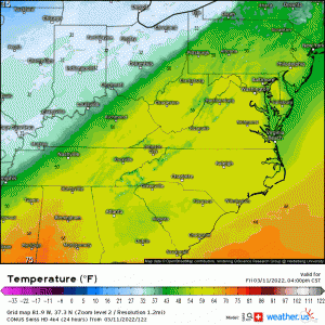
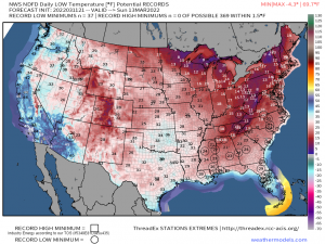
By Sunday morning, the Arctic air has truly settled in. Can you find the 32 degree line? No, you’re not seeing things. It is indeed found roughly one third into the Florida peninsula.
As indicated by the map, these will be widespread record-breaking lows. Unfortunately, many trees/plants/flowers are in bloom currently. Significant time below freezing can kill sensitive plants so, if you have any, take steps to protect them.
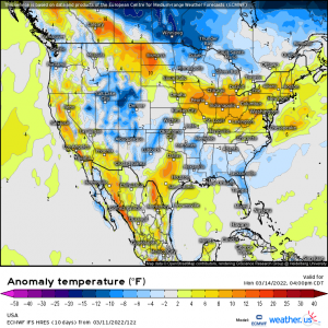
The upside to this cold is that it doesn’t linger.
By Monday afternoon, many of us are back to near, or even above normal. Thank goodness, right?
But will this be winter’s last gasp? It’s too soon to tell… but we can hope.



Great article
I wonder if I need to reload the site homepage to get the latest articles. I enjoyed the maps and text is super informative. I would have enjoyed this much more on 3/11 (before the event ).