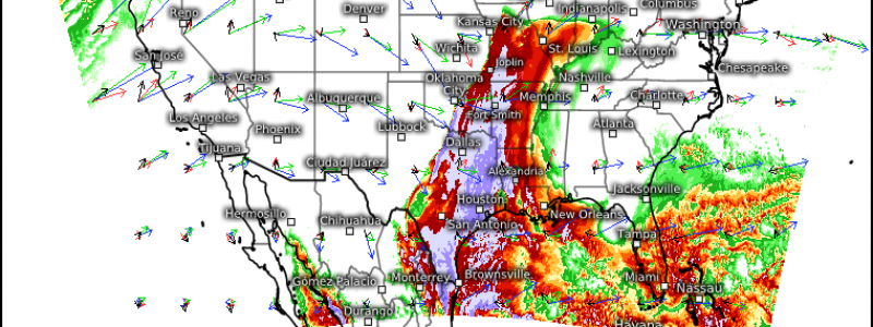
Multi-Day Severe Threat Targets the Eastern Half of the US
We have a very active weekend, weather-wise, ahead of us. It’s as if the atmosphere has decided to throw just about everything it has at the US, and all in the next two days. We’ve got (mountain) snow storms, a bomb cyclone, and multiple days of severe weather. The only thing we’re missing is a hurricane.
This blog will focus on the severe threat. If you’re interested in the bomb cyclone, Jacob will be/has already put together a separate blog, so make plans to check it out.
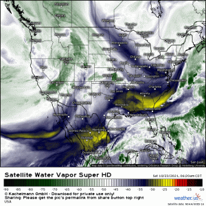
We have multiple days of severe weather ahead, thanks to an amplifying shortwave rolling out of the western US.
If you’ll check out that water vapor loop, not only will you notice the shortwave, but you may also notice the very dry air in place over the Eastern US. A front rolled through only 2 days ago, wiping out much of the moisture that would be needed to fuel severe weather.
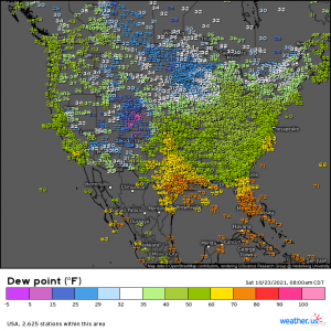
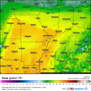
But if we take a look at current dew points:
We see that the moisture is already making it’s return. Dewpoints in the 60s are creeping into the central Plains states, where this event will kick off today. And that moisture return will only intensify once a surface low forms and deepens as it moves east.
Let’s take a look at the threat day by day to make it easier to understand.
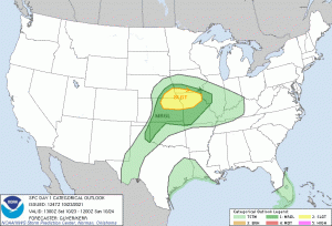
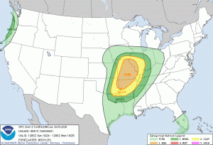
**note: I’ll be sharing the SPC outlooks as it is the best way to convey the affected areas. Please remember not to focus so much on the “scary” level of the colors. If your area is under any color for any day we’re discussing, you have a chance at severe weather and should prepare accordingly**
Saturday
This will likely be the weakest, relatively speaking, of the threats over the next 3 days. Mainly because things are still getting going. We don’t have solid moisture in place yet and a surface low hasn’t formed.
That said, there are still hazards of the severe persuasion to contend with.
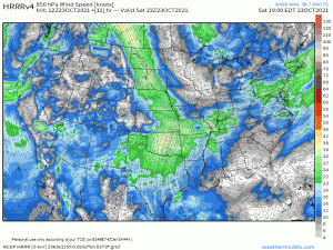
Though there will be storms with the potential for hail possible in this region this morning, the low level jet will really begin to ramp up this evening and overnight.
This will, of course, advect enough moisture into the area to fuel a greater severe threat – with the main hazard being damaging hail.
This is an overnight threat, beginning after sunset and likely persisting through the early morning hours, though weakening with time. If you’re in the defined area, take steps to protect your vehicles, etc., if possible.
And, as always, have ways to receive warnings. Though hail is the main threat tonight, there is a non-zero chance of a tornado, especially in southeastern Kansas. Have a plan in place incase you should need it.
Sunday
This will be the most potent round of severe weather this event has to offer. All hazards are on the table including a potentially significant tornado threat, at least early in the event.
As we saw in the Saturday outline, the low level jet will ramp up in the overnight hours, so by Sunday morning, unstable air will already be moving into place.
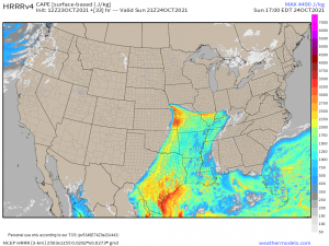
Destabilization will be aided by broken cloud cover ahead of and behind any leftover convection from the previous night. By the afternoon, a corridor of CAPE on the order of roughly 1500 to 3000 J/kg will be available to fuel developing storms ahead of an amplifying trough.
Convective initiation is expected in the late afternoon.
Any discrete cells that form early in the event will have the potential for severe hail and a stronger tornado or two. Upscale growth will occur relatively quickly and discrete convection will transition to a MCS. Aside from the reduction to the threat of severe hail once this occurs, primary threats do not change much. Supercells embedded in the line will be capable of tornadoes. Damaging straight-line winds are also a possibility.
This line is expected to weaken with time into the overnight hours, however, it will still be capable of damaging winds.
Timing for this event is late afternoon on Sunday into the early hours of Monday. The western periphery of the defined area will see the overnight threat.
Be sure to have multiple ways to receive warnings, including at least one that will wake you. Consider sleeping in your safe space if you are forecast to see overnight activity. It will cut down on valuable time that will otherwise be wasted scrambling from your bed to your safe space if a warning is issued.
Monday
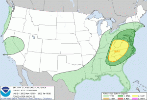
The severe threat continues into the Mid-Atlantic on Monday.
Though instability won’t be as potent here, ample shear could promote the development of supercells as the line sweeps east into what instability exists.
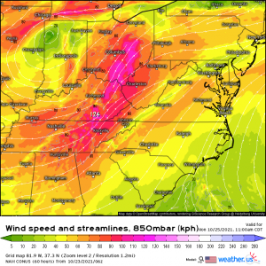
The low level jet will strengthen during the early afternoon hours.
As both speed and directional shear increase, any supercells able to take advantage of the limited instability may pose a tornado threat. This threat looks to target mainly East Tennessee, Eastern Kentucky, and perhaps western West Virginia in the late afternoon hours.
The line is expected to move over the Appalachians and into the coastal Mid-Atlantic in the evening/overnight hours. With the loss of daytime heating, the main threat is expected to transition to isolated wind damage.
Anyone in the defined area should have ways to receive warnings. Those on the eastern periphery should be sure to have at least one way that will wake you as this will be an overnight event for you.
I know that was a lot of information but I tried to hit the important points without being overwhelming.
Summary: A multi-day severe threat exists this weekend. Though Sunday will hold, by far, the most potent threat, both Saturday and Monday have their own threats to contend with. A tornado can not be ruled out for any of the three days. Wind damage and hail is also possible, with the hail threat being mostly confined to Saturday and Sunday.
Have multiple ways to receive warnings and a plan to shelter ready to go if you should need it. If you’re expecting an overnight threat, make sure those warnings will wake you if need be.
Stay up to date with your local NWS branch and/or your local broadcast meteorologists.
Stay safe, y’all!


Ein Kommentar zum Beitrag