Why So Warm, East Coast?
Good Monday morning!
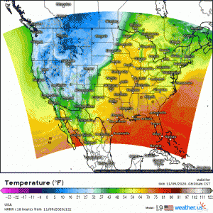
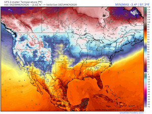
Well, it’s another day of record highs in the east. A warm start this morning, especially in the south, will lead to another comparatively hot, sunny day. A decent portion of the west, on the other hand, will barely rise above freezing.
(link: https://weather.us/model-charts/rapid-us/usa/20201109-1400z.html)
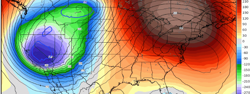
If it sounds like I’m tired of this pattern, I am. I am probably in the minority here but I crave cool, rainy days, especially in the fall. Change comes, though. A cold front will sweep east toward the middle of the week, finally breaking our deep trough, strong ridge pattern.
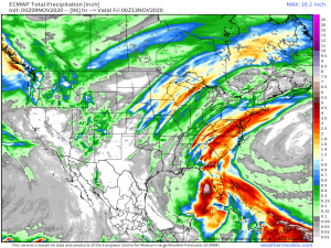
In an event known as a PRE (predecessor rain event), the cold front will bring heavy amounts of rain enhanced by the moisture from Eta. If you’d like more info on what a PRE is and how it works, please see Jacob’s blog from yesterday here.
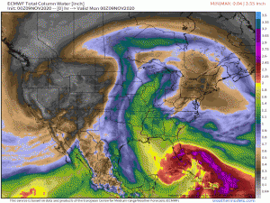
As seen in the above gif, the moisture from Eta will be advected north by a southeasterly flow present in the warm sector of the approaching cold front bringing more than adequate moisture into the east. While we won’t see flooding on the scale that South Florida is currently experiencing due to Eta, widespread totals of 2 to 5 inches can be expected, especially across the mid-Atlantic.
Eta will wander the Gulf this week, mainly offshore until the incoming cold front introduces westerly shear and forces it to dissipate as it is swept East. Behind the front, the northeast will cool down significantly, while the south will see only a slight change in temperature, unfortunately.
I’m just asking for daytime highs in the 50s. Is that too much? Apparently this year, despite our early-season cold snap, it is.
But why, exactly is that? Well, we are currently in a La Nina pattern. No doubt you’ve heard terms like “La Nina” and “El Nino” thrown around in weather forecasts year after year but what exactly does it mean for you?
La Nina is an “enhanced normal” phase of ENSO (El Nino Southern Oscillation). ENSO is a climate pattern that emerges based on changes in the sea surface temperature of the eastern and central tropical Pacific Ocean. Through teleconnections, changes in SSTs cause changes in local weather, which change the weather downstream (in other parts of the world). 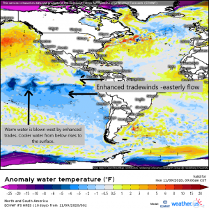
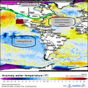
(link to SST map: https://weather.us/model-charts/euro/americas/anomaly-sea-temperature-f/20201109-1500z.html)
In a La Nina year, the easterly tradewinds found in the low latitudes become enhanced, or faster than usual. They then essentially blow the relatively warm water normally found in the Eastern Pacific to the west, causing cold water from well below the surface to rise and replace it. The cold water then helps to stabilize the atmosphere above it, leading to an area of sinking, dry air. This then has an effect downstream on the Atlantic Basin.
Sea surface temperatures in the Atlantic, which have already been higher than normal in recent years, become further enhanced facilitating rising air over the Atlantic basin. Rising air and high SSTs are fuel to tropical cyclones and this generally results in a more active hurricane season, such as we have seen this year. However, it also effects the weather in the continental US.
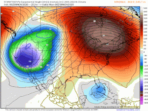
The polar jet stream during the winter splits into two over the Pacific Ocean due to a persistent high pressure area that resides south of Alaska. It then drives the upper portion of the polar jet stream to the north, while the lower portion swings around the high pressure from the south. The southern portion of the jet stream then brings moist air into the northwestern US, keeping it wet throughout the winter. The jet stream then rests across the midwest, blocking any truly cold air from reaching the southern and mid-Atlantic states. Thus, they are kept generally warm and dry throughout the duration of the La Nina event.
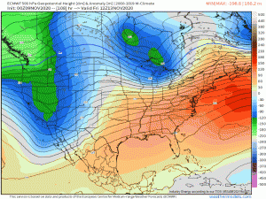
As seen in the gif, once our cold front passes through the East Coast, a pattern very similar to the one I’ve outlined above begins to set up.
Your take-away here: Don’t expect any lasting truly cold weather in the south/mid-Atlantic any time in the near future. We are likely to remain warm and relatively dry (with the exception of systems such as Eta bringing us precipitation) for awhile while the west/northwest holds on to the cool air and moist environment.
As far as Atlantic Hurricane season 2020 goes, it’s not over yet, folks. The NHC has identified two new areas to watch. One, newly dubbed Invest 97L, is currently in the open Atlantic and given at 70% chance at formation. The other is a tropical wave in the Caribbean currently given a 50% chance of development. Still lots to watch as we move through November. Keep an eye on our blog. Jacob and I will be keeping you updated if anything develops.
Have a wonderful day, y’all!
