Major Winter Storm For the Upper Plains Late Week? Polar Plunge Coming!
An anomalous mid/upper level trough, which is a part of an ongoing active pattern out West that’ll bring heavy snowfall to place such as the Sierra & Cascade mountains this week, will eject into the upper Plains later this week. It’s this trough, behind a strong polar cold front, that’ll likely set the stage for a major winter storm for places like Dakotas, Minnesota, some portions of Wisconsin, and the upper peninsula of Michigan. This also sets the stage for lake effect snow as ingredients will be favorable to “kickstart” that process with a strong cold front and cold air advection behind, while inducing lake effect as colder and drier air advects across Lake Superior and Michigan.
Starting off with the mid-level heights, we can see a robust mid-level trough cut-off, and “bowl” its way into S.D. and into MN. Out ahead, strong forcing for ascent will likely cause a complex situation of rain mixing with sleet and eventually snow as the surface low strengthens and robust dynamics kick in.
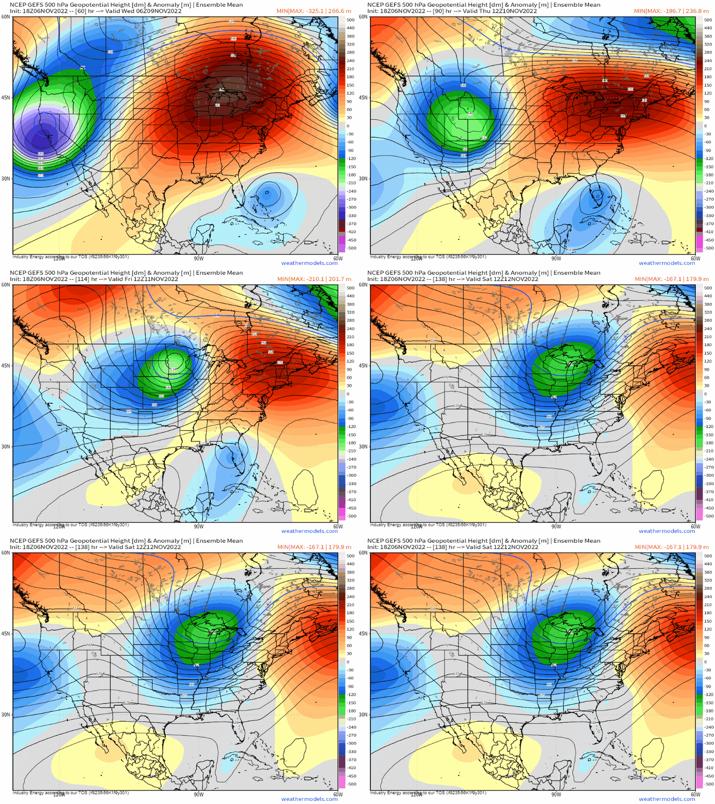
The low pressure will spawn east of the Rocky mountains, which is essentially lee cyclogenesis – a notorious meteorological process that tends to happen on the leeward side of mountain ranges. It’ll then gradually strengthen as the mid and upper levels strengthen, further inducing upper level divergence (i.e. left exit region of the upper level jet and diffluent flow downstream of the trough axis) as the entire trough axis tilts negatively.
The track of this low pressure will take a track likely from western NE into south-central S.D. and into the middle portion of MN before ejecting on into Southern Canada.
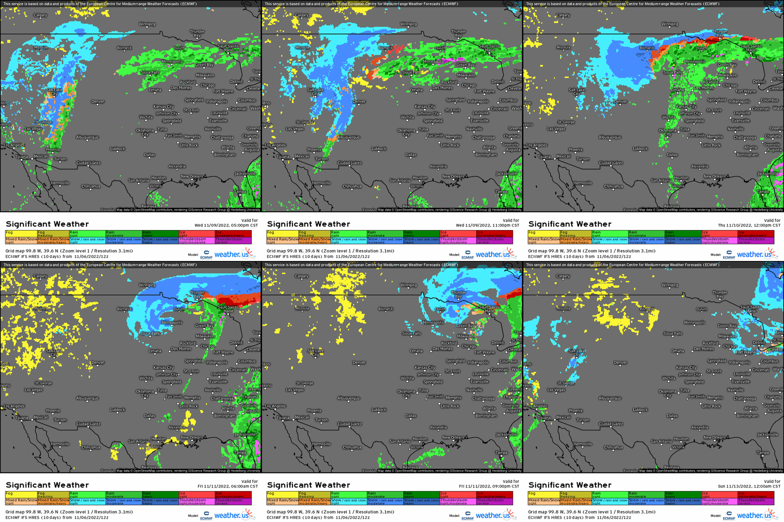
Precipitation will begin out likely as rain/snow mix with snow on the backside of the low pressure (i.e. WY, western SD and ND), along with even heavy rain (maybe few rumbles in warm sector) into MN. As the surface low deepens and shifts eastward, much of non-frozen precipitation will changeover to snow and/or mix before becoming all snow as the low pressure shifts into the Great Lakes. The timeframe for this event appears to take place by Thursday afternoon and wrap up by later Friday.
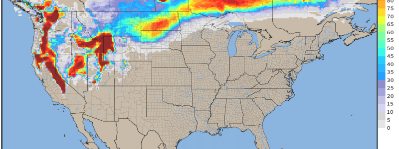
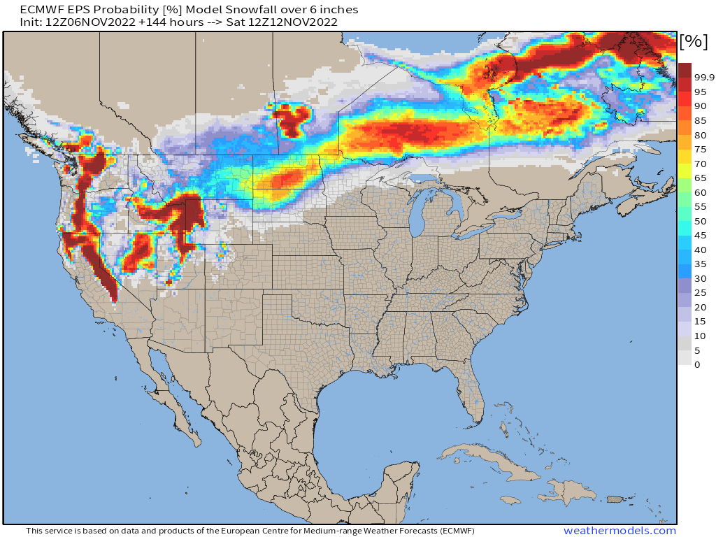
We’re likely looking at a general swath of 6”+ from NW SD/ C ND (between I -90 and I -94) into NW MN, with a larger envelope of at least several inches of snow for the north-central states bringing about the first plowable event of the season. Looking at the EURO ensembles from a probabilistic standpoint, you can see the general outline of where there is the greatest risk for over 6”+.
It’ll truly feel like winter once this system then pushes out, and a very cold polar-continental air mass follows behind delivering the coldest temperatures of the season for the upper Plains and into the Midwest. We’re going to see temperatures anywhere between 10 to as much as 30 degrees below normal! It’s this air mass that’ll slowly bleed eastward, bringing an end to the anomalous warmth in the mid-Atlantic and Northeast.
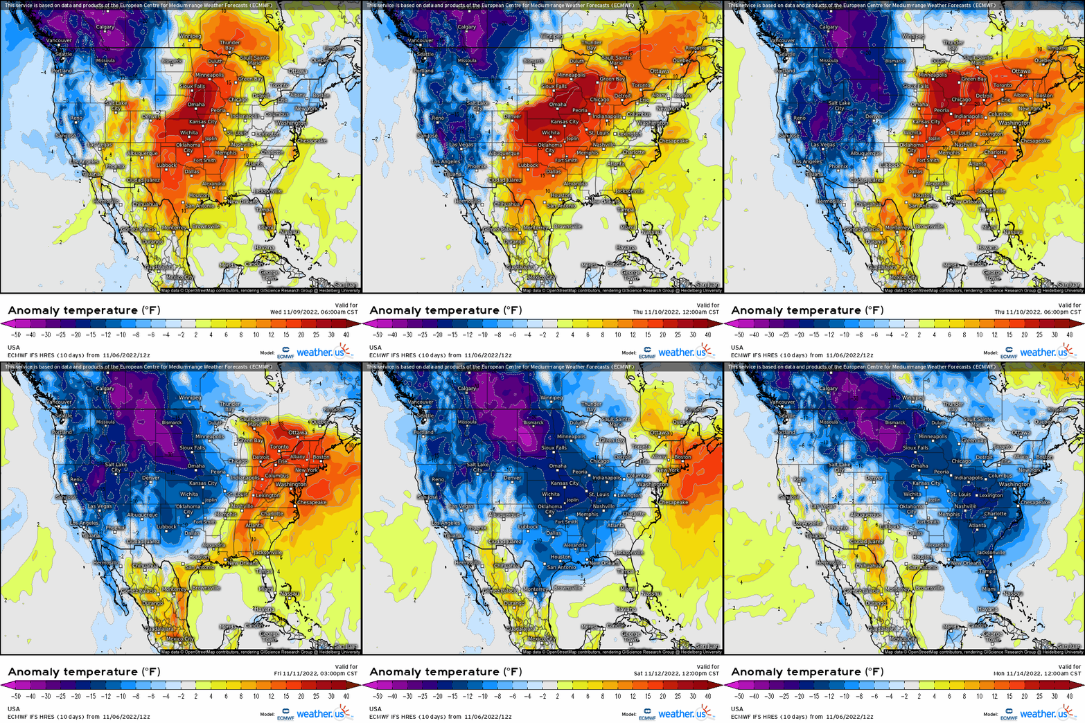
Another reminder that we’re inching very close to the true official start of the winter season, as more blues begin to show up than greens on those precipitation modeled outputs!


