Major Atmospheric River Set To Impact California
Hello everyone!
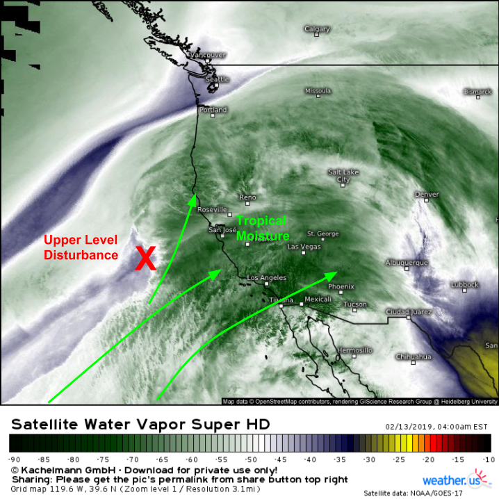
A major atmospheric river event will impact California over the next several days as low pressure develops over the Pacific Ocean to the west of the state. This event will be different from previous systems as it will be much warmer and much wetter due to its ability to pull moisture straight from the deep tropics. The snowpack in the Sierra Nevada is quite robust after a series of recent storms, and the upcoming warm temperatures combined with heavy rain will result in substantial melting of that snowpack at lower elevations. Flooding will thus be a serious concern as we head closer to the weekend.
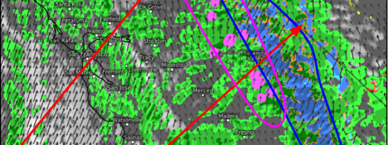
The event is already beginning this morning as a weak upper level disturbance gets ejected out of an upper level low offshore. This disturbance is tapping deep tropical moisture, resulting in heavy rain and mountain snow across the Northern part of the state. You can follow that rain and snow with HD radar imagery. Click the map to zoom in, or click one of the yellow circles to select a different radar station.
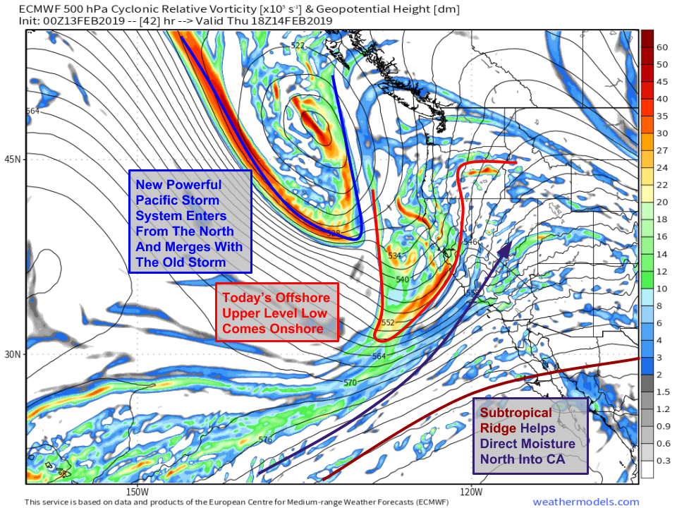
While today’s rain might be heavy in some parts of the state, the main event doesn’t arrive until tomorrow. Remember today’s event is being driven by an upper level disturbance rotating around an upper level low. Tomorrow, that entire upper level low will move onshore while at the same time merging with a new strong storm entering from the Gulf of Alaska. While these systems are interacting to the California’s northwest, a subtropical ridge will be building to the state’s south. That ridge will help direct moisture north into the state, where it will combine with the strong upward motion from the storm system to create heavy precipitation. Map via weathermodels.com.
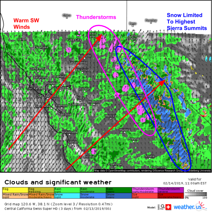
Our Swiss Super HD model gives a good overview of what to expect in California tomorrow as the storm moves in. Heavy rain showers will be widespread across the state, with the heaviest precipitation falling on SW facing mountain slopes. Strong SW winds responsible for carrying the warm moist airmass into the region will be felt especially in higher elevation areas and along the coastline. The tropical airmass will even be sufficiently warm and moisture laden to produce some thunderstorms, especially where upward motion is enhanced by the Sierras. Speaking of the Sierras, snow levels will be on the higher side for this system, generally above 7,500 feet. Heavy rain in the valleys will lead to flooding concerns as the robust snowpack left from previous storms begins to melt.
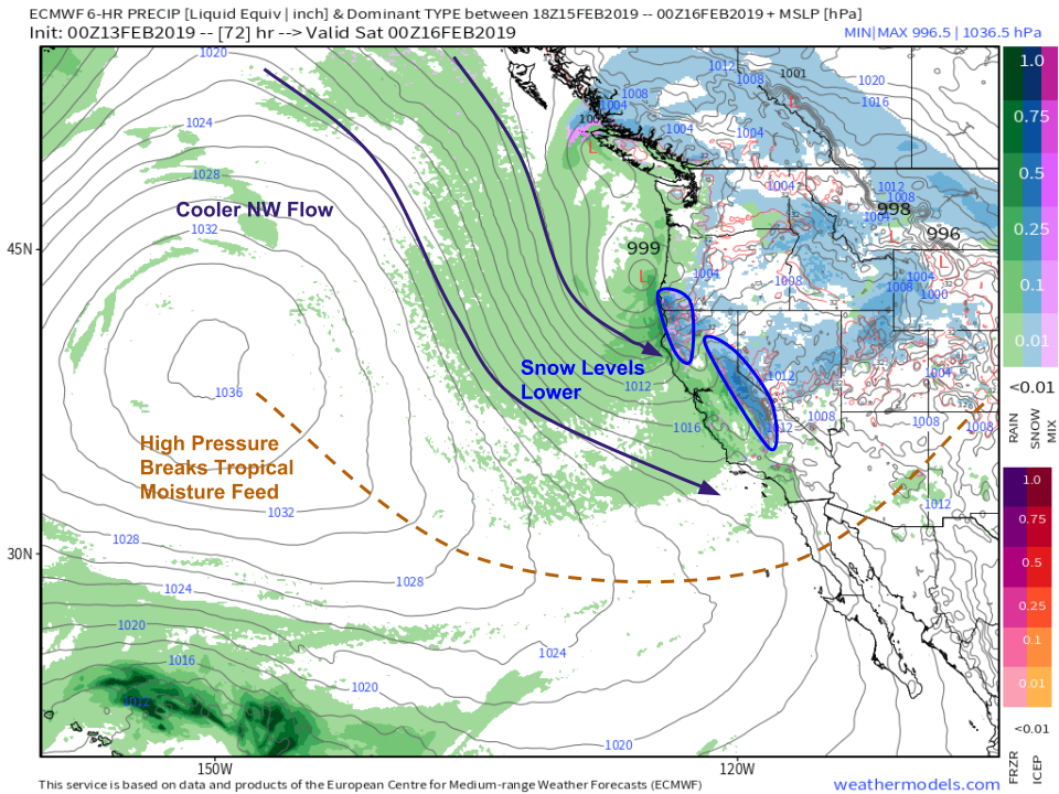
On Friday, high pressure building south from Alaska will cut off the deep tropical moisture plume and cooler NW flow will take over both near the surface and aloft. This means that precipitation won’t quite be as heavy as yesterday, but snow levels will drop significantly to around 4,000 feet. A few feet of additional accumulation are expected in the Sierra during this time. Map via weathermodels.com.
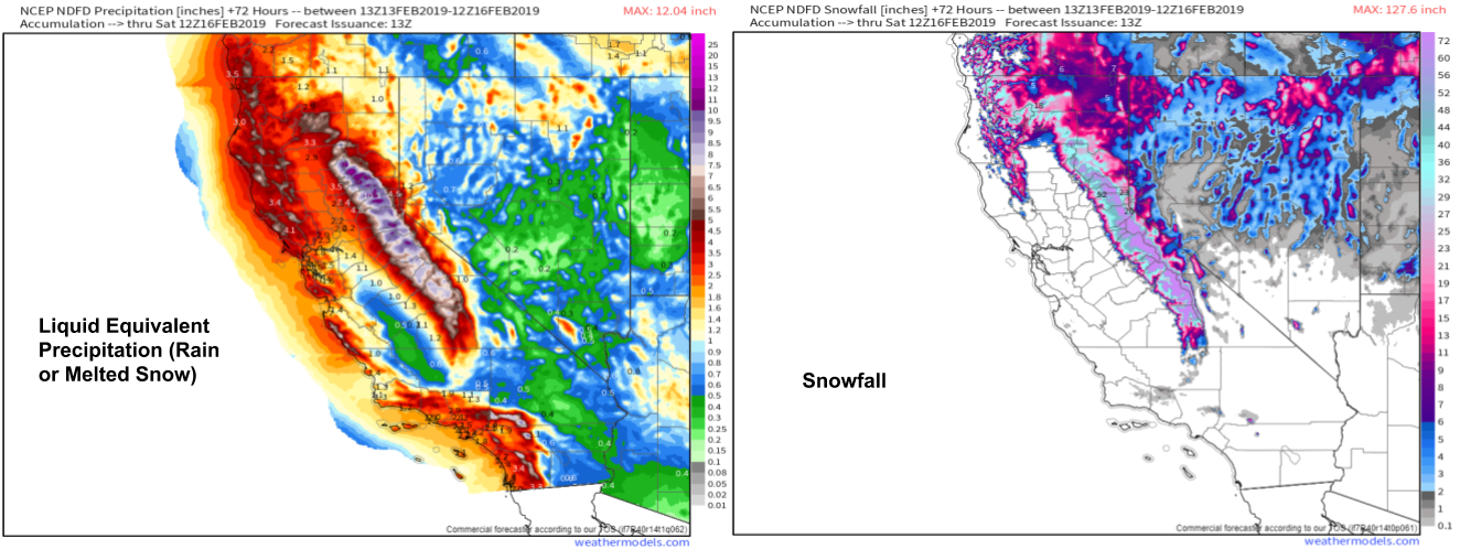
So how much rain and snow is expected? Here’s a look at the NWS forecast for both liquid equivalent precipitation (either how much rain, or how much rain you would’ve gotten if all your snow fell as rain) and accumulated snow. California’s coastal mountains are looking at 3-6″ of mostly rain, while the Sierras see 6-10″ of liquid equivalent falling mostly as snow (in the higher elevations). Flash flooding and mudslides will be a concern in all areas that see heavy rain, especially those that are lacking vegetation from recent wildfires. Dry weather will return to California this weekend. Maps via weathermodels.com.
-Jack
