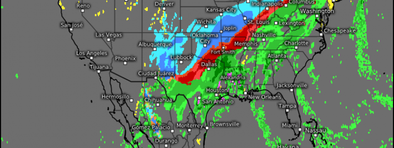
Another Wintry Mess
Another week, another impactful winter storm. Unlike last weekend’s event, the effects of this storm is forecast to be particularly widespread and rather varied. Winter storm watches and warnings are currently active in a line from Southwestern Texas to Northern Vermont.
The Set-Up
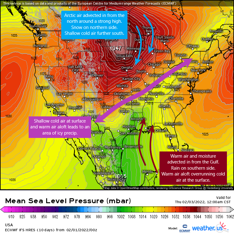
- An area of strong high pressure will begin moving southward out of Canada into the North-Central US. It will advect in Arctic air, providing well-below normal temperatures.
- Southerly flow from the Gulf will advect in warm air and moisture into the Southeast US. Temperatures will be above normal and fairly spring-like.
- A broad area of low pressure will develop a drape a slow-moving cold front over the Central US.
- Shallow cold air at the surface will combine with warmer air aloft in a classic overrunning event.
Impacts
Impacts for this storm will greatly depend on your geographic location.
- Those closer to the high and more firmly under the influence of cold air will see snow, potentially significant.
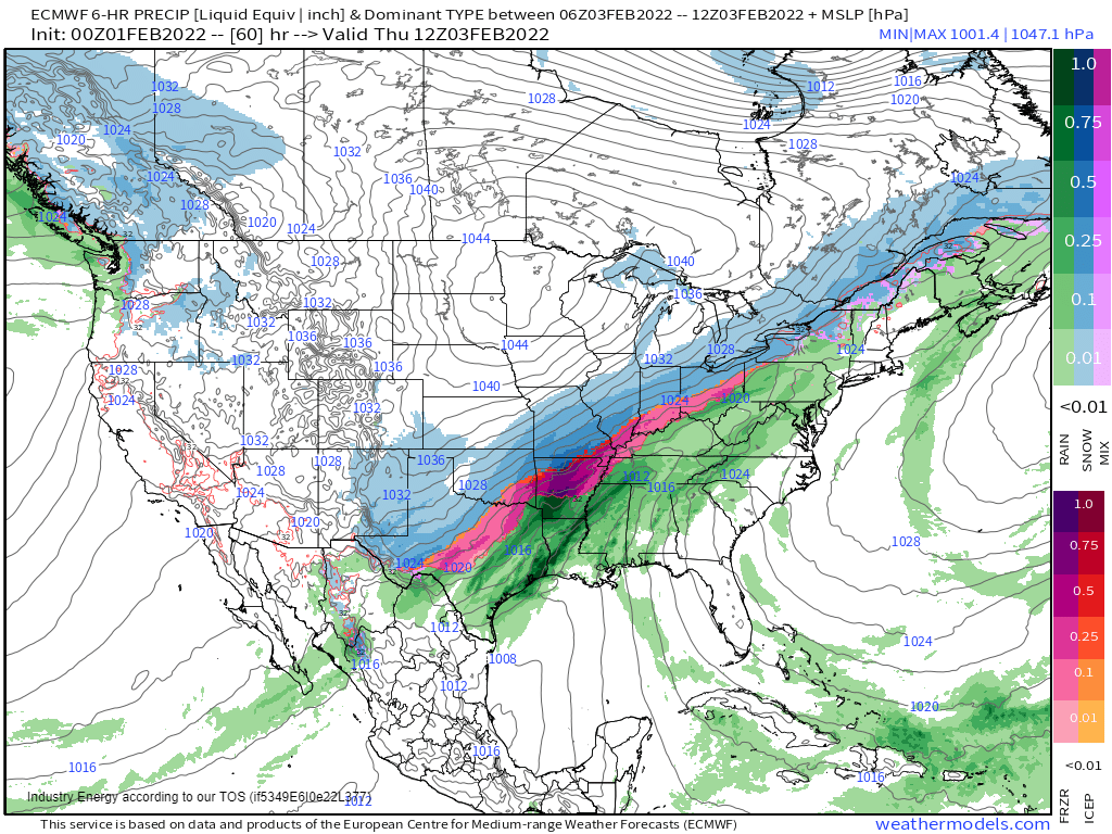
- Those located nearer to the broad low where a shallow layer of cold air exists at the surface, but a warmer layer exists aloft, will see a bit of a mixed bag. Potential exists for significant icing issues.
- Those further south of the broad low will see rain and perhaps a brief transition to mixed precip or snow as the cold front passes. Potential exists for heavy, flooding rains and perhaps a severe storm or two in the deep south/Gulf Coast region.
Snow
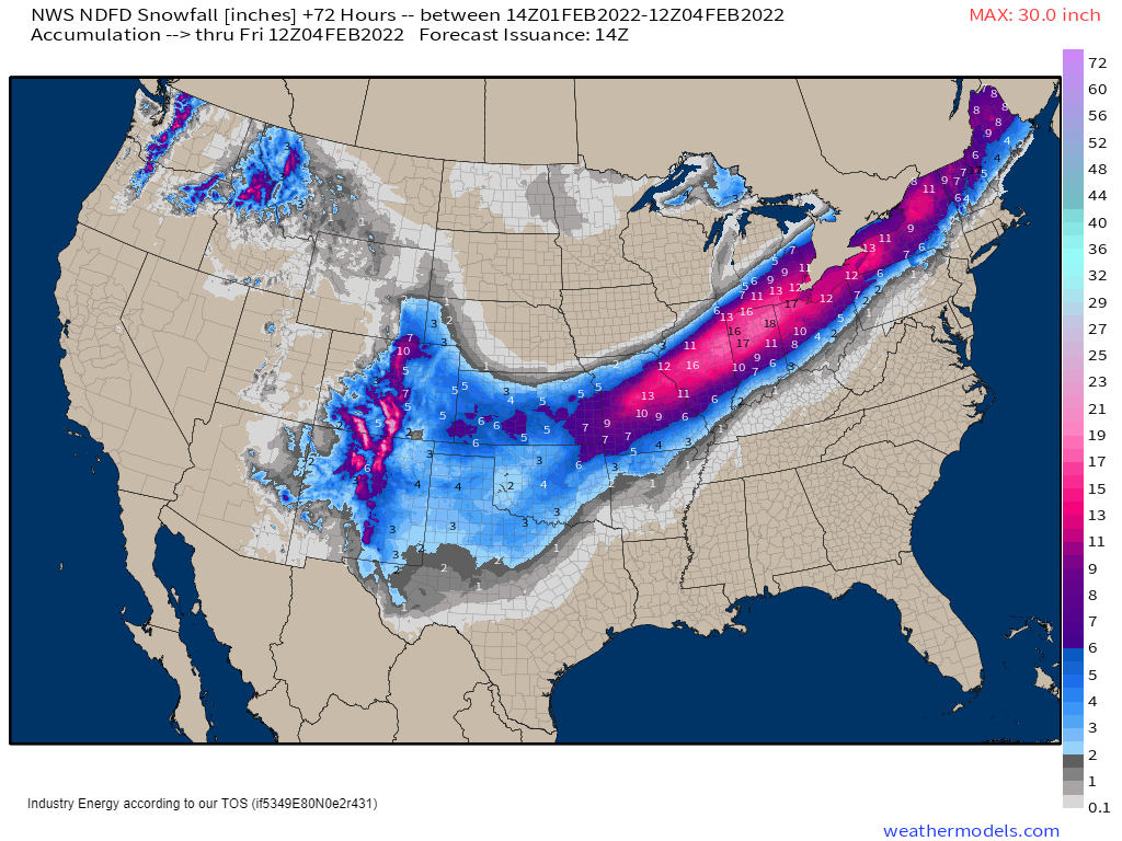
As mentioned above, those who are more firmly rooted in the cold air, but also still close enough to benefit from the northward flow of moisture, will see the highest snowfall totals. As of right now, that area seems to be the Midwest/Lower Great Lakes region.
A very sharp gradient of snowfall totals will exist on the northern side as cold, dry air works to put an end to the moisture streaming north.
For example: A large metro like Chicago could easily range from an inch or less on it’s north side to nearly a foot on it’s southern side. This gradient will be fickle and tough to forecast as it greatly depends on how far north substantial moisture can make it before the dry air takes over and shuts it down.
As for the southern side, totals may be a bit diminished by warm air aloft leading to prolonged periods of mixed precip. Snowfall here will greatly depend on how quickly the transition from mixed precip to snow can occur. The longer it remains mixed, the less chance of any meaningful snowfall.
Ice
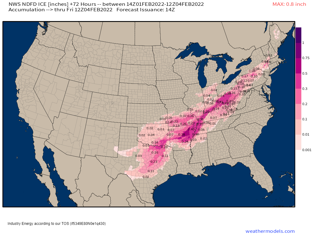
Though many are more focused on how much snow will fall in their area, the ice threat from this storm is undoubtedly the more significant aspect. Potential exists for rather significant icing to occur, especially closer to the broad low where cold air is the most shallow and overrunning of the warm air is most persistent.
Quick Precip Type refresher:
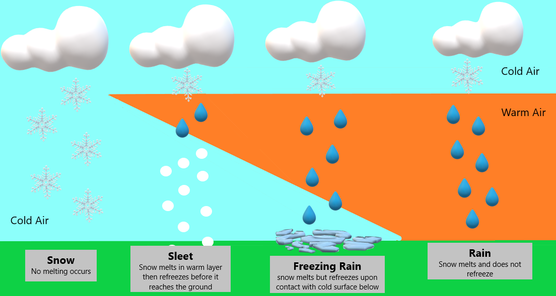
Your precip type will depend on just how shallow that layer of cold air is.
- A deeper layer of cold air combined with a relatively shallow layer of warm air aloft lends to sleet.
- A more shallow layer of cold air at the surface combined with a deeper layer of warm air just above the surface lends to freezing rain and ice accumulation.
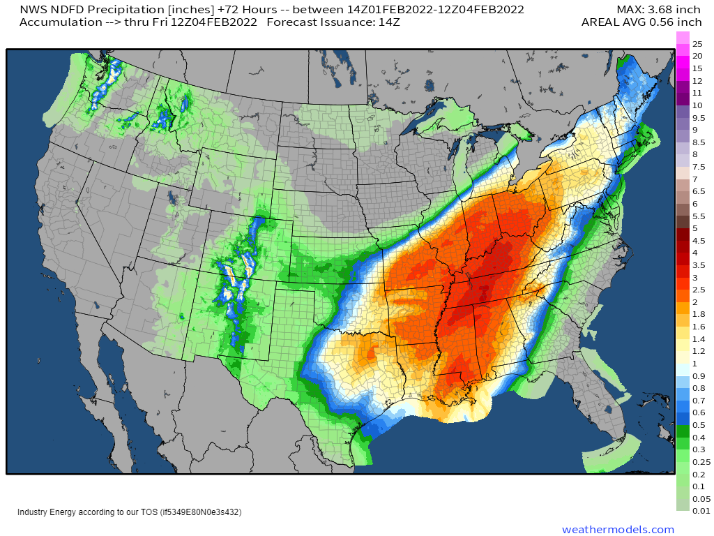
Even 0.10″ of ice can be impactful. So, when we look at this forecast and see values of 0.20″ – 0.50″ forecast, it’s time to pay attention. With that much ice accumulating on colder surfaces, travel becomes extremely dangerous if not impossible. Power outages become increasingly likely as the weight of the ice on trees will bring down branches which may bring down powerlines.
If you’re in a region expecting ice, prepare to stay home. Stock up on your essentials today. Prepare for possible power outages. Remember that significantly below average temps will be present once the cold front passes through so make the necessary preparations to stay warm should you lose power.
Rain
On the southern, warmer side of this storm, heavy rain is likely. Multiple rounds of showers will roll through beginning late today before finally moving out by early Saturday. These showers could be heavy, especially in the Tennessee and southern Ohio Valleys where the flow will nearly parallel the surface boundary and training is possible.
Flooding is a concern, especially in the aforementioned areas.
A few severe storms are also possible, mainly on Thursday.
This risk should remain confined mainly to the Deep South/Gulf Coast region through Thursday afternoon.
Damaging winds and a few tornadoes are possible, but with weak forcing outside of the cold front itself and only marginal instability, the magnitude of this threat is somewhat in question. Any upward trend in instability can change this, however, so monitor this threat if you’re in the region.
That about wraps up our broad look at this winter weather event. For a closer, multi-parameter look at the specific conditions in your area, head on over to the forecast tools at weather.us or the City Charts section at weathermodels.com.
About the author

Meghan Gulledge
Meteorologist - Mississippi State '22 Writer for Weather.us and Weathermodels.com. Focused on Weather Communication. BoyMom x1, CatMom x5. Twitter: @MegGulledgeWX