Nor’easter Continues To Impact North Carolina Today, Will Head For The Northeast Tomorrow
Hello everyone!
The nor’easter I discussed a couple days ago has indeed formed off the Carolina coast, and has by now attained its maximum strength. The storm will be slow to weaken as it moves slowly northeast today, and strong winds will continue impacting the Outer Banks until tonight. If you’re curious why this storm is moving so slowly, or why the coastal flooding in North Carolina has been so bad, I discussed that in more detail back on Thursday. This post will focus on the storm’s future as it heads towards New England tonight and tomorrow.
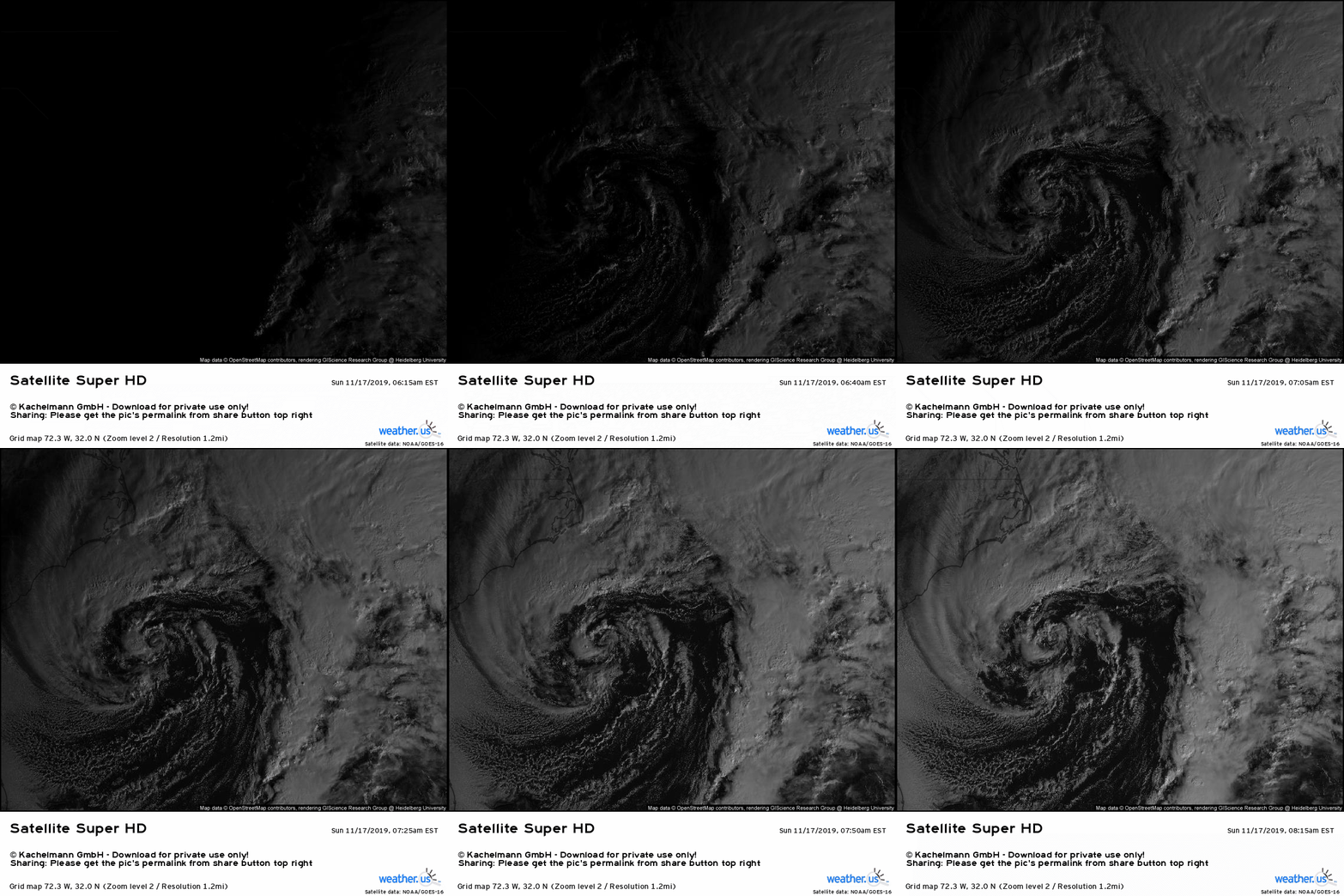
The storm has a neat appearance on satellite imagery this morning as its ‘inner core’ (the swirly part) has become somewhat separated from the warm conveyor belt (where all the thunderstorms are moving northeast). There’s plenty of convection ongoing even to the north and northwest of the center, so while this is certainly not a tropical cyclone, it is tapping into the ocean’s energy a bit more than the typical winter storm. You’ll notice this storm is in no hurry to go anywhere at the moment, which is exactly what we expected given the “split flow” pattern of the jet stream. Thankfully for the Outer Banks, the storm will lose a bit of its lethargy today in response to another storm currently moving through the Plains.
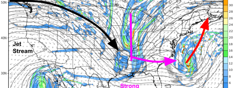
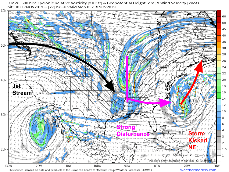
The ECMWF’s 500mb vorticity forecast for tonight illustrates the effect this disturbance will have on our storm. Note the remnant split flow pattern over the East Coast, as well as the strong unified jet entering North America over British Columbia. The leading edge of this jet is a strong disturbance currently moving through the Plains that will cross the Mississippi River tonight. As that disturbance approaches the East Coast, it will be turning the winds ahead of it towards the southwest. The storm off NC will begin moving NE in response to that, which will lead to improving conditions across the Outer Banks and deteriorating weather farther north in New England. Map via weathermodels.com.
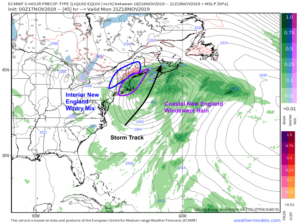
The storm’s impacts in New England won’t be nearly as severe as those along the Outer Banks, but coastal parts of the region will see minor to moderate coastal flooding due to strong onshore winds. Interior New England will see precipitation falling through warm air in the mid levels of the atmosphere into a shallow layer of cold air left over from the Arctic high pressure system currently located over the region. The result will be a wintry mix of freezing rain and sleet. While ice accretion will likely remain below the thresholds for widespread power outages, slick travel and some scattered outages are expected in the mountains of VT, NH, and ME. As cold air filters in behind the system, freezing rain will change over to snow on Tuesday with minor accumulations expected in the same mountain regions favored for freezing rain. Map via weathermodels.com.
-Jack


