Significant Cold Air Outbreak Expected Across The Plains/East This Week
Hello everyone!
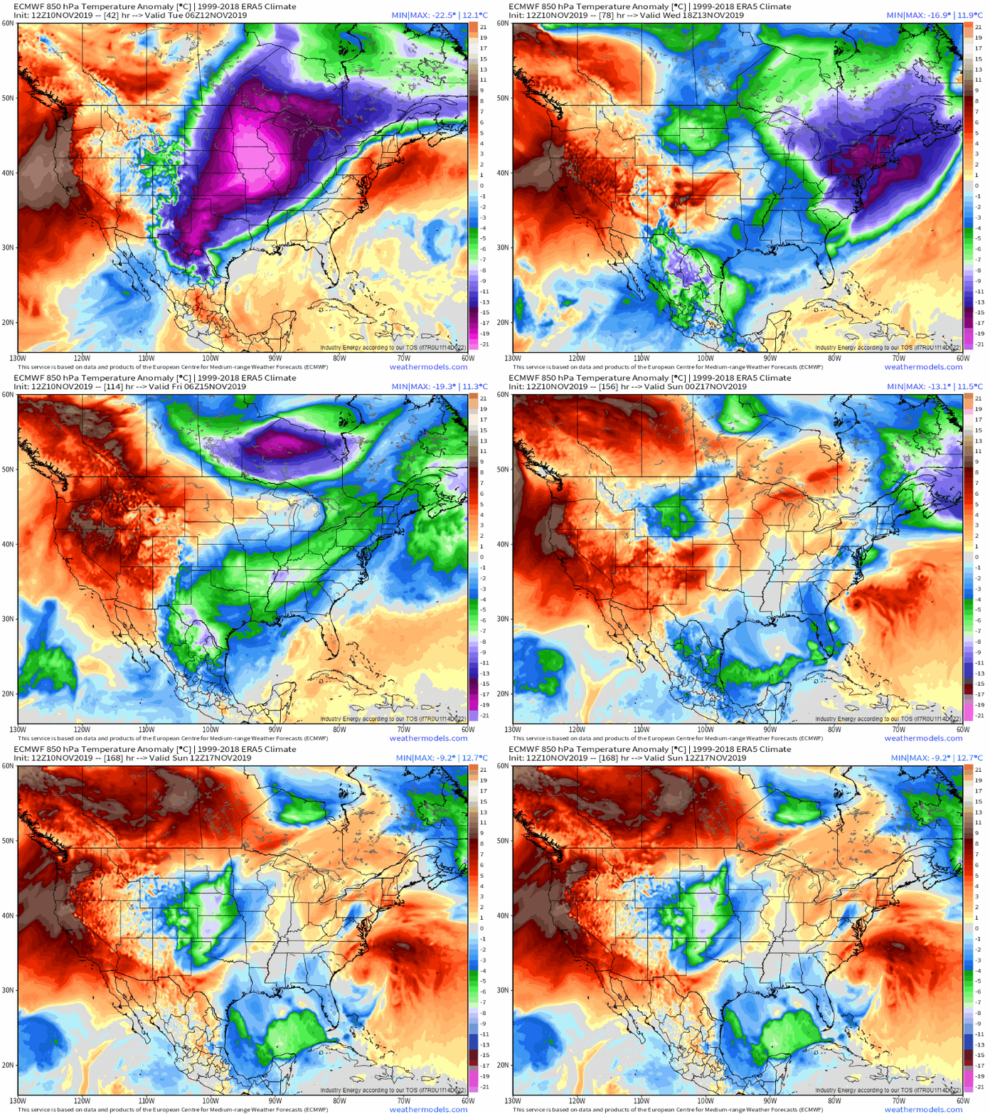
A significant outbreak of cold air will impact the eastern two thirds of the country this week after a strong cold front moves offshore on Tuesday. If you’re located east of the Rockies and north of Tampa FL, you can expect significantly below-average (and perhaps even record low) temperatures along with wind chills that may be dangerous for sensitive groups, and perhaps even some wintry precipitation. This post will discuss the cold airmass, while details on the snow/ice expected on the leading edge of the storm can be found in a separate post coming later this evening.
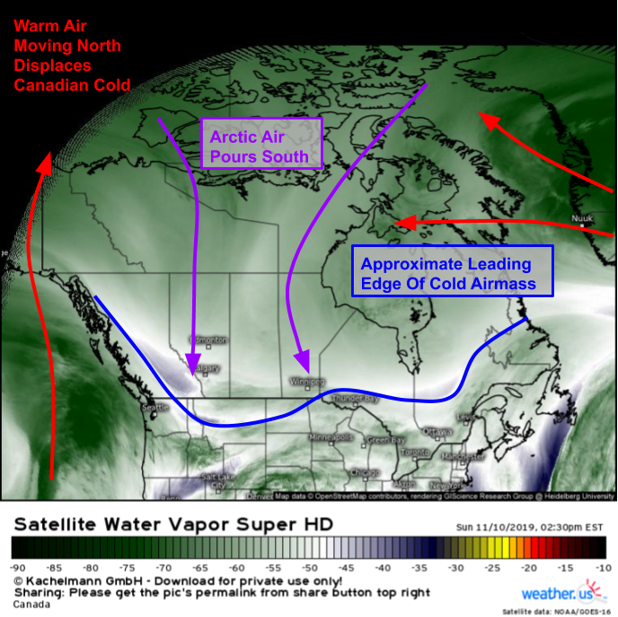
The forces pushing the cold airmass southeastward show up clearly on WV satellite imagery this afternoon. Powerful storms are carrying warm air northward over the Pacific and Atlantic oceans. This warm air is displacing the cold air that has been building up over the Canadian Arctic over the past week or so, giving it no option but to go southward. An area of low pressure over Hudson Bay is also helping to push the cold air towards the US. The leading edge of the cold airmass has already moved into parts of the Northern Plains and Rockies, where temps are currently falling through the teens.
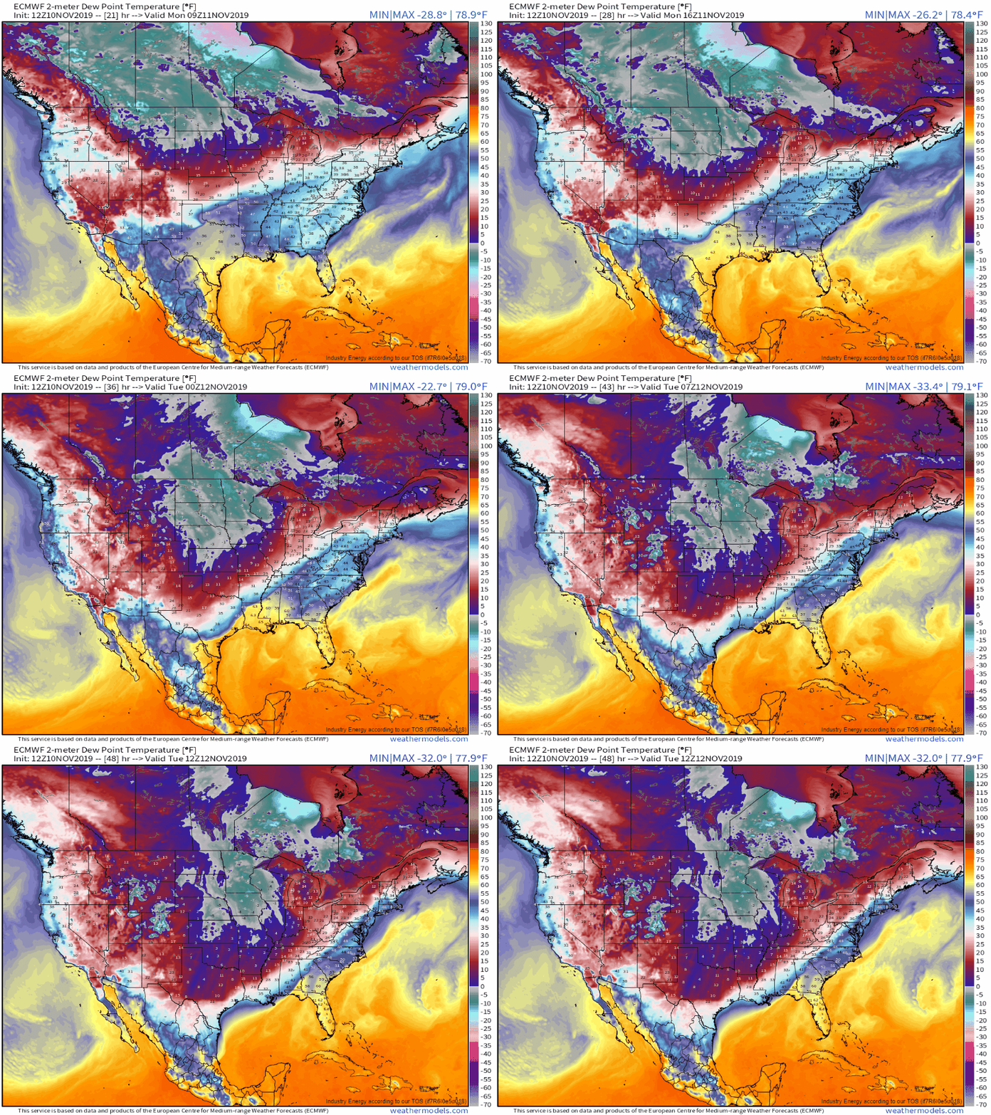
The cold air will rapidly spread southeast during the day tomorrow and Tuesday as shown by the hourly ECMWF dew point forecast looped above. GIF via weathermodels.com.
As a quick side note, you may be wondering why I chose dew points instead of actual temperatures to depict a cold airmass moving southward. The reason is that cold air is quite dry, but the dew point doesn’t fluctuate very much from day to night, making loops like this much smoother than temperature fields that have diurnal noise. You may also be wondering what exactly the dew point is. Feel free to check out this post for an explanation of the parameter and its relevance.
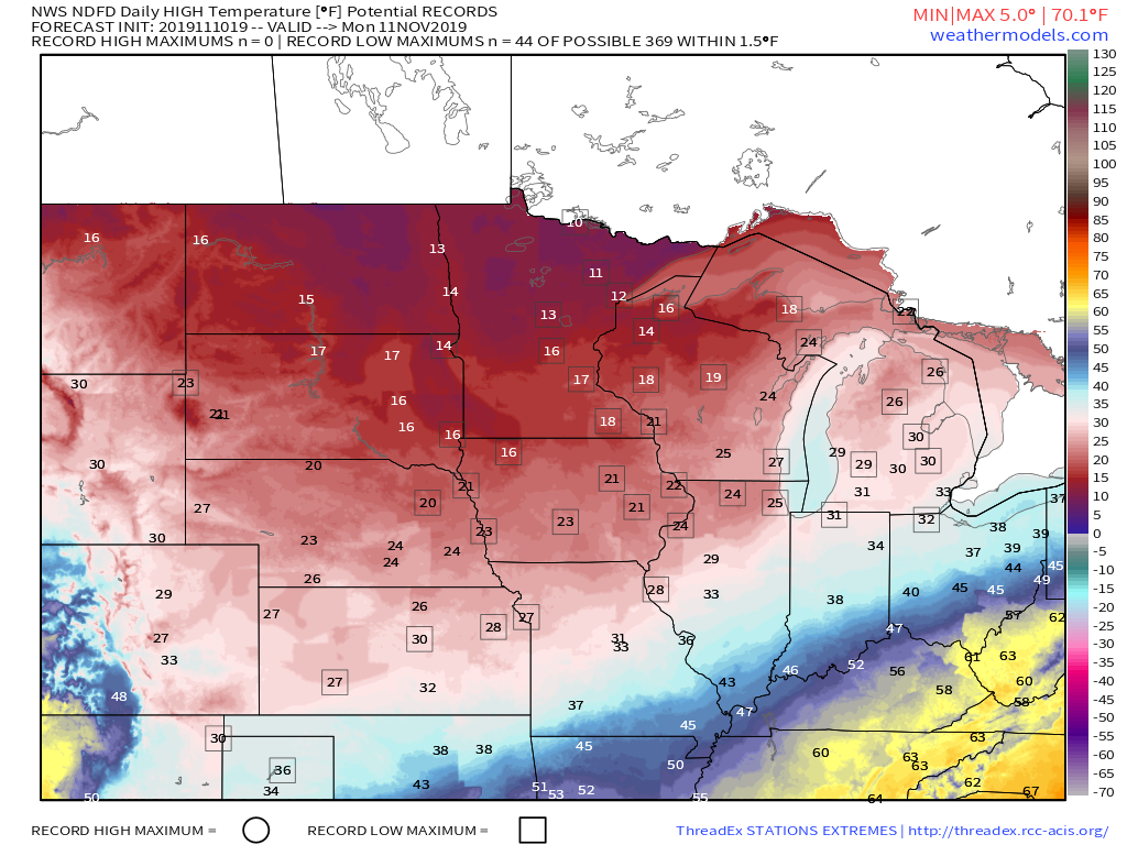
Tomorrow, the chilliest temps will be found across the Plains and western Great Lakes. NWS forecast data indicate that 44 stations could tie or break daily low maximum temperature records. Because we’re still in early/mid November, even record or near-record low temperatures won’t be terribly cold in the grand scheme of things. That being said, brisk NW winds and temps falling into the single digits at night will be dangerous for those most exposed/sensitive to the cold. Make sure you bring any outdoor pets inside, and take precautions to prevent frozen pipes etc. Map via weathermodels.com.
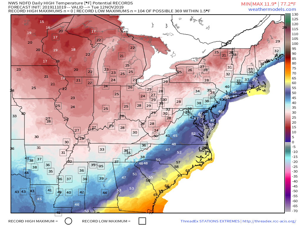
By Tuesday, the cold will be moving east into the Ohio Valley and interior parts of the Northeast/Mid Atlantic. The airmass will be modifying (warming) as it moves southeast and soaks up heat from the sun and the still-relatively-warm ground, so dangerous cold is not expected southeast of the St. Louis-Chicago area. That being said, subfreezing temps following rain/snow/ice on Monday will create slick spots on the roads, so take care if you’re headed out and about on Tuesday morning along/west of the Appalachians. Map via weathermodels.com.
Low temperatures on Wednesday morning will fall below freezing all the way to the Gulf of Mexico which will result in the end of the growing season for areas that haven’t yet seen a hard freeze. If you still have sensitive plants outside in the Florida Panhandle or anywhere in Alabama/Mississippi/Louisiana/SE Texas, be ready to bring them inside by Tuesday. Map via weathermodels.com.
The coldest air will quickly move east into the Atlantic by Thursday, with a slow warming trend continuing through next weekend. GIF via weathermodels.com.
Perhaps you can pick out a developing swirl near North Carolina near the end of the loop above. There’s some chance a coastal storm will develop in this region near the end of the week, but there’s still plenty of uncertainty regarding its exact track and intensity, which will determine what impacts will be felt from it. I’ll have more updates later in the week if that system appears likely to develop into something impactful.
-Jack
