5/8-5/12 Forecast Discussion – Storms And Snow Continue Across The Plains Heading Into Mother’s Day
Hello everyone!
There will be plenty of active weather over the next several days as an upper level disturbance lifts out of the SW US, through the Plains, and eventually into the Great Lakes. Severe thunderstorms will be the primary threat, along with very heavy rains that are likely to exacerbate ongoing flooding issues in parts of SE TX. Though we’re now moving into the middle part of May, snow is also in the forecast across parts of Colorado and the northern Great Lakes. The below video will give an overview of what to expect as we move into Mother’s Day Weekend.
Focused Discussion: SE TX Heavy Rain/Flooding
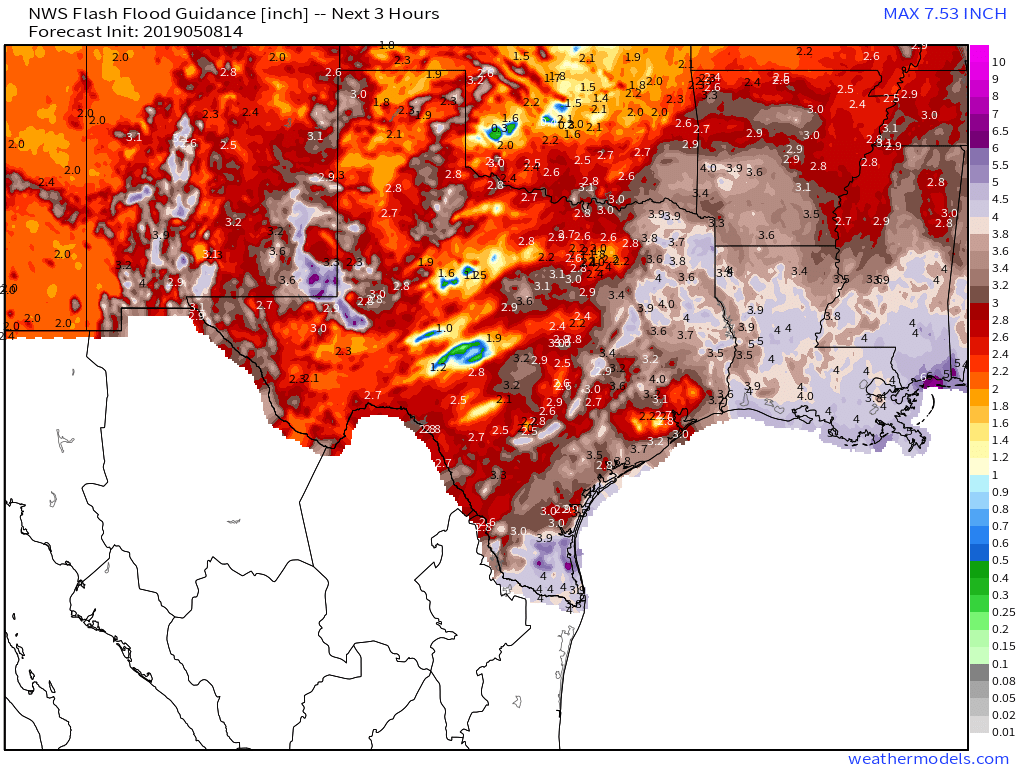
This map is available in the weathermodels.com lab (click the map to be taken to that page), and shows how much rain needs to fall in three hours to result in flash flooding. Note that there’s a local minima near Houston, where only 1-2″ is needed over a three hour timespan to cause flash flooding. This increased sensitivity is largely due to yesterday’s heavy rains which indeed caused several instances of flash flooding.
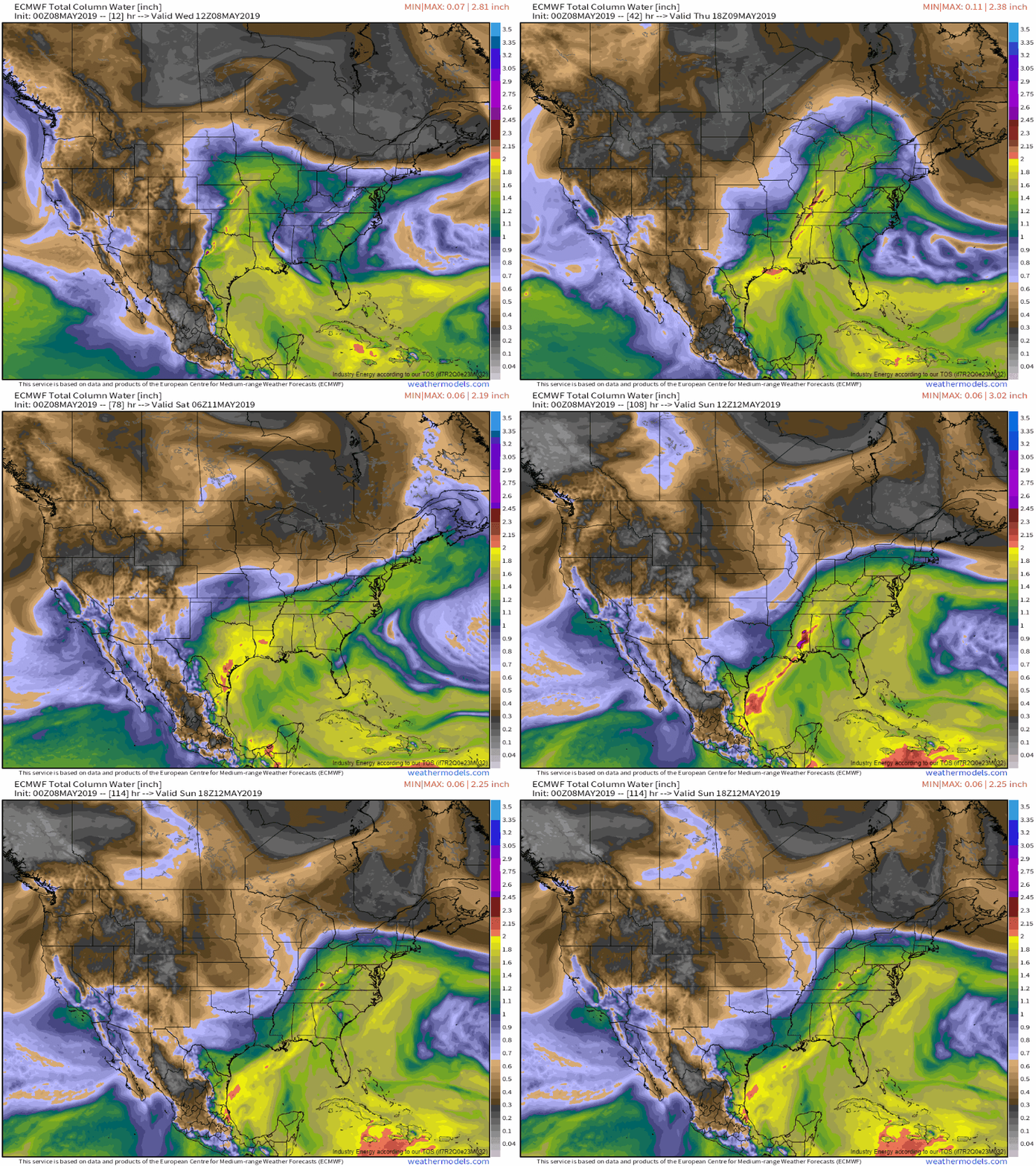
Here’s a look at the ECMWF’s precipitable water forecast for the next several days (through Sunday) showing deep tropical moisture lingering in SE TX as well as adjacent parts of LA and AR. PWAT values above 2″ (the red colors) are supportive of extremely heavy rain, given a sufficient mechanism to trigger thunderstorm development.
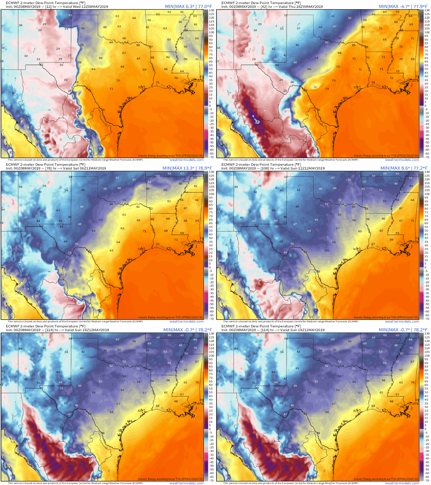
Unfortunately, a boundary will be lingering near the Texas coast as we head into the weekend. Note the dry airmass (lower dew points) sink southward through the state today and tomorrow, before getting hung up near the coast. The presence of this frontal boundary means that storms will pop up as temps rise each day. Those storms will then be able to tap into the deep tropical moisture discussed above to drop a lot of rain.
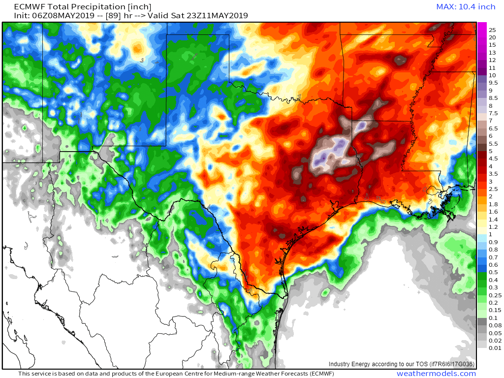
Here’s a look at the ECMWF’s forecast for total precip through Saturday evening. Of course actual amounts will depend largely on where individual storm cells pop up, so don’t focus too much on the amounts given for a specific point, but do note that a large swath of eastern TX is likely to see 3-5″ or more of rain. Much of this will fall in short periods of time due to the fact that the rain will be coming from thunderstorms instead of large-scale forcing features that distribute rainfall more evenly.
Drier air will sweep through the state on Sunday as another disturbance swings east out of the Rockies.
For more information on what to expect in your town, head on over to weather.us and type your town’s name into the search box.
-Jack


